|
Location
Yakke Parsan has to be reached on foot. It is not easy to get to as it is set back from the road and has a canal running along its western side.
To get there drive to Bostan. Head west out of town on the main road that leads to the sports stadium. Turn right in front of the stadium and after
0.7km as the road bends to the left, take the only right turn. Continue along this road for 12.8km and then take a side turn to the right. After
1.8km the road kinks left and then right to cross a canal. Yakke Parsan is clearly visible just 1km to your right. You have to scramble along the
bank of the canal to reach it.
Yakke Parsan
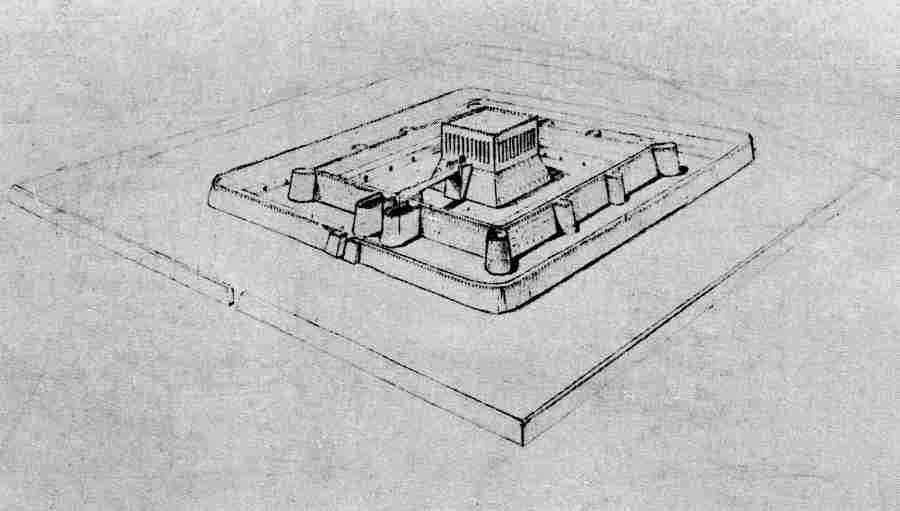
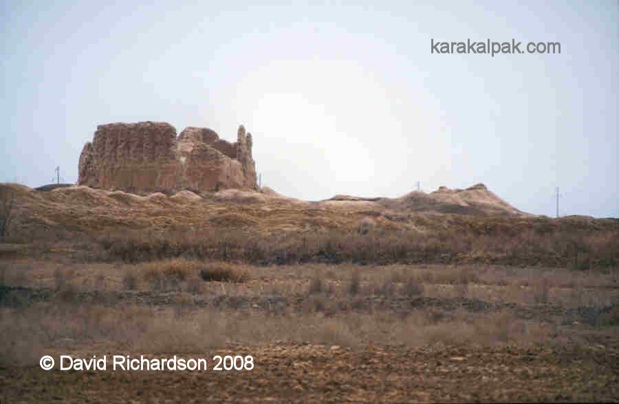
Yakke Parsan is an impressive fortified manor house dating from the 6th to the 8th centuries of the Afrigid era. It would have been the residence
of an important feudal lord.
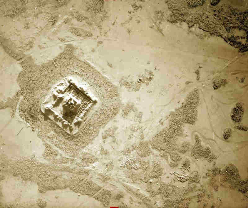
Aerial photograph of Yakke Parsan taken by the Khorezm Archaeological Expedition.
It was briefly surveyed in the late 1930s but only properly excavated in the 1950s. It has a central habitable tower, about 20 by 20 metres square.
Inside was a central room roofed with an arched cupola with doors opening onto two side lobbies containing a number of smaller rooms. The tower was
surrounded by an outer defensive wall, about 68 by 68 metres square, reinforced with corner and side towers. There was a single entrance defended by
a pair of towers. Over time the space between the tower and the outer walls became filled with small houses for the servants and estate workers.
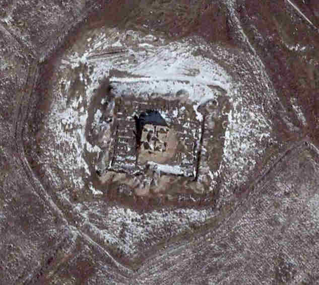
Satellite image of Yakke Parsan. Image courtesy of Google Earth.
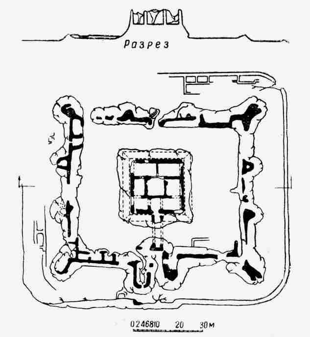
Schematic plan of Yakke Parsan. Image drawn by V. I. Pilyvsko.
As Khorezm had expanded and grown prosperous during the first half of the first millennium AD, a new class of feudal landowners had emerged. They were
the offspring of the ancient nobility, senior courtiers, or those who had been rewarded for loyal military service. They were known as dihqans,
literally village lords or squires, and their agricultural estates were called rustaq. As their feudal estates multiplied, so power drained
from the urban centres and the cities fell into economic decline.
Most dihqans lived in small square-shaped forts, known as habitable towers or donjons, surrounded by a defensive wall. These were
often located at the head of the canal that watered their agricultural lands, where they could control the irrigation system. From their
donjons they ruled over their individual fiefdoms, composed of the families of feudal serfs who managed their lands and produced their
craftwork. The distribution of feudal forts tended to have the highest density in the best agricultural regions. For example, in the oasis of
Berkut qala, there were about one hundred fortified manor houses during the feudal period. Sadly most of the feudal donjons in Khorezm have
been destroyed during the past seventy years as a result of intensive agricultural development, especially during the 1960s and 1970s.
|
Yakke Parsan in 2003.
Reconstruction of Yakke Parsan by N. P. Tolstova.
By the 6th to the 7th centuries the architecture and construction of these rural fortifications had reached an advanced stage of development. The
donjons were built on a 6 to 8 metre high paqsa base in the shape of a tall truncated pyramid, with crenellated external walls
and a shooting gallery around a castellated parapet. They were sometimes surrounded by a massive wall and ditch and had a single well-defended entrance,
sometimes located in a separate tower accessed via a drawbridge. One of the later two-storey donjons at Berkut qala even had a secret
passageway through its paqsa foundation into the surrounding town. The interior of the donjon was a residence for the
dihqan and his immediate family, while the servants, slaves and kedivars lived in buildings gathered around the foot of the castle.
Excavations have shown that the internal decoration of these forts could be magnificent, depending on the wealth and nobility of the owner. For
example, Teshik qala had walls decorated with a clay frieze depicting rosettes and palm trees.
During the excavations of Yakke Parsan a number of documents were discovered, written in the Khorezmian language. Archaeologists also found the remains
of a felt carpet.
Google Earth Coordinates
The following reference point (in degrees and digital minutes) will enable you to locate Yakke Parsan on Google Earth.
| | Google Earth Coordinates |
|---|
| Place | Latitude North | Longitude East |
|---|
| Yakke Parsan | 41º 55.270 | 61º 1.105 |
| | | |
Note that these are not GPS measurements taken on the ground.
Visit our sister site www.qaraqalpaq.com, which uses the correct transliteration, Qaraqalpaq, rather than the
Russian transliteration, Karakalpak.
Return to top of page
Home Page
|